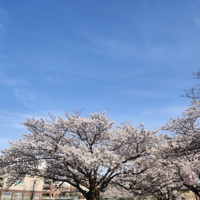
(050/122)
| GPS Altitude | 75.7 m Above Sea Level |
| Make | OnePlus |
| Y Cb Cr Sub Sampling | YCbCr4:2:0 (2 2) |
| File Inode Change Date/Time | 23-07-14 09:57:11 |
| ISO | 100 |
| Directory | 2023-03 IETF 116 Yokohama and AsiaBSDCon Tokyo, Japan |
| Components Configuration | Y, Cb, Cr, - |
| Capture Mode | Photo |
| Shutter Speed | 1/1682 |
| Image Height | 3000 |
| Y Cb Cr Positioning | Centered |
| Light Value | 12.2 |
| Thumbnail Image | SCALAR(0x37a78fddc28) |
| Exif Byte Order | Big-endian (Motorola, MM) |
| Y Resolution | 72 |
| Interoperability Index | R98 - DCF basic file (sRGB) |
| Exposure Compensation | 0 |
| Scene Capture Type | Standard |
| Is HDR Active | False |
| Image Width | 3000 |
| GPS Longitude Ref | East |
| File Size | 3.4 MB |
| Thumbnail Offset | 1141 |
| Compression | JPEG (old-style) |
| X Resolution | 72 |
| Encoding Process | Baseline DCT, Huffman coding |
| Create Date | 23-03-28 15:25:19 |
| Modify Date | 23-03-28 15:25:19 |
| Scene | AutoHDR |
| ExifTool Version Number | 12.98 |
| Sub Sec Time Original | 040219 |
| Image Size | 3000x3000 |
| Create Date | 23-03-28 15:25:19 |
| Orientation | Horizontal (normal) |
| MIME Type | image/jpeg |
| Flashpix Version | 0100 |
| File Type Extension | jpg |
| Exposure Time | 1/1682 |
| File Modification Date/Time | 23-03-28 06:25:18 |
| Focal Length | 4.8 mm |
| File Access Date/Time | 24-11-11 15:55:35 |
| Circle Of Confusion | 0.005 mm |
| Scale Factor To 35 mm Equivalent | 5.7 |
| Lens Facing | Back |
| File Type | JPEG |
| Brightness Value | 7.24 |
| GPS Longitude | 139.636240 E |
| White Balance | Auto |
| Is Night Mode Active | False |
| GPS Latitude | 35.453221 N |
| Sensing Method | Not defined |
| GPS Position | 35.453221 N, 139.636240 E |
| Megapixels | 9.0 |
| GPS Date/Time | 23-03-28 06:25:06 |
| Exif Image Height | 3000 |
| Metering Mode | Center-weighted average |
| Scene Type | Directly photographed |
| X Resolution | 72 |
| Camera Model Name | GM1913 |
| XMP Toolkit | Adobe XMP Core 5.1.0-jc003 |
| Hyperfocal Distance | 2.59 m |
| Scene Detect Result Confidences | [0.9833559, 0.8941178, 0.0] |
| Y Resolution | 72 |
| GPS Altitude Ref | Above Sea Level |
| File Name | IMG_20230328_152518.jpg |
| Scene Detect Result Ids | [42, 914, 0] |
| Max Aperture Value | 1.6 |
| Image Width | 3000 |
| GPS Longitude | 139.636240 |
| Image Height | 3000 |
| Exposure Program | Program AE |
| Modify Date | 23-03-28 15:25:19 |
| Date/Time Original | 23-03-28 15:25:19 |
| Light Source | D65 |
| GPS Altitude | 75.752 m |
| Field Of View | 67.4 deg |
| Color Components | 3 |
| Aperture Value | 1.6 |
| Color Space | sRGB |
| GPS Processing Method | GPS |
| Exif Version | 0220 |
| GPS Latitude | 35.453221 |
| Resolution Unit | inches |
| Resolution Unit | inches |
| Bits Per Sample | 8 |
| Sub Sec Time Digitized | 040219 |
| Sub Sec Time | 040219 |
| File Permissions | -rw-r--r-- |
| Thumbnail Length | 25037 |
| Aperture | 1.6 |
| GPS Date Stamp | 2023:03:28 |
| Shutter Speed Value | 1/1682 |
| Is Bokeh Active | False |
| Flash | Off, Did not fire |
| Focal Length | 4.8 mm (35 mm equivalent: 27.0 mm) |
| Exposure Mode | Auto |
| Focal Length In 35mm Format | 27 mm |
| Date/Time Original | 23-03-28 15:25:19 |
| GPS Latitude Ref | North |
| Exif Image Width | 3000 |
| GPS Time Stamp | 06:25:06 |
| F Number | 1.6 |
| Orientation | Horizontal (normal) |